Protecting catchments with planned burns in South East Queensland
A program of planned burns will see South East Queensland utility Seqwater protect water catchments and the local community from bushfires during the warmer months of the year.
Justin Lee, Seqwater’s Principal of Recreation and Catchment Services, said the utility is committed to proactive fire management across its catchments as a way of reducing fuel loads, protecting bulk water supply and infrastructure, and mitigating bushfire risk to the land Seqwater manages and neighbouring properties.
“Planned burning mitigates risk to water quality and our communities,” he said.
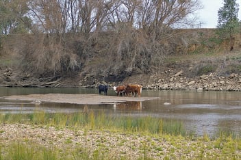
“Seqwater is working to ensure a safe, secure bulk drinking water supply for more than 3.6 million people across South-East Queensland.”
The utility’s rolling annual planned burn program is one of a number of tools it uses to manage fuel load, hazardous fuel arrangement and bushfire risk within its catchments.
“Burn implementation is seasonal in nature and requires a significant regional effort to safely deliver it in the likely burn window period, which is generally in the months from March to September each year,” Lee said.
“Our Seqwater Operations team, assisted by a specialist Fire Management team, facilitate the burn implementation process, and deliver the program safely within the planned burn guidelines.”
While wet weather delayed the scheduled burn in 2022, this year’s program is on schedule, with burns in April carried out at Leslie Harris Dam (Tingalpa) and on Minjerribah (North Stradbroke Island), followed by Lake Manchester and Gold Creek Dam (Brookfield).
“Various factors such as extreme weather, heatwaves, droughts, or floods events can impact burn implementation and can narrow the windows of opportunity on any given year,” Lee said.
“Seqwater’s fire management strategy is based on conducting planned burns to create a fuel mosaic pattern – implemented under a ‘cool burn’ strategy. This plan mitigates the potential of high intensity bushfire, while assisting the effective post-burn recovery of vegetation and associated habitats.”
Reducing risk
Lee said the planned burn program contributes to Seqwater’s responsibilities to protect life, property and the environment, and is implemented with the aim of reducing hazardous fuel load levels and mitigating risk to key infrastructure.
As part of its bushfire risk management planning responsibilities, the burns also help maintain and improve the biodiversity of the targeted areas and contribute to managing weeds and pests.
“Appropriate fire management is important for our neighbours and surrounding communities; Seqwater takes our fire management responsibilities and statutory obligations seriously,” he said.
“Without planned burning, Seqwater could not adequately reduce bushfire risks.”
According to Lee, recent years have seen improvements in Queensland’s bushfire hazard assessment and improved approaches to mapping methodologies, which have helped agencies like Seqwater better identify risk.
“This bushfire prone area mapping tool and underlying methodology provides a major improvement in the bushfire threat assessment, practical utility of spatial information provided to partner agencies to assess risk areas and the planning of strategies to mitigate impacts of future bushfires through land management planning,” he said.
“Seqwater is also utilising bushfire hazards assessments through the third-party assessments of current and future state improvements to catchment land.
“For example, Seqwater has a catchment management improvements plan where we may revegetate land from pasture back to the original regional ecosystem to protect our land from catchment water quality risks and improve biodiversity.
“This process can require the implementation of appropriate buffer zones to mitigate fire risk to communities into the future.”
In touch with the community
Part of Seqwater’s job when conducting the burns is to identify locations that provide habitats for endangered or threatened flora and fauna species.
“We are careful to identify these areas and target fire management under appropriate prescriptions or exclude fire in areas of rainforest,” Lee said.
“The areas of protected wildlife habitat, essential habitat and high-risk areas for protected plants are identified by referencing the Regional Ecosystem layers in our [geographic information system] and site assessment prior to any burn implementation.”
The utility also checks for cultural heritage sites, as well as monitoring for water quality mitigation zones and revegetation plantings, rainforest and vine thicket vegetation, threatened plants and significant fauna habitats.
“Seqwater is agile and changes the planned burns program to accommodate changing risks as urban footprint increases,” Lee said.
That also means ensuring a rigorous internal and external stakeholder process with partner agencies, regional councils, Traditional Owners and government departments.
“Consultation is via regional meetings – such as the Fire Management Groups – formal letters, letterbox drops, community meetings as required for community fire planning engagements,’ Lee said.
“Seqwater also maintains social media posts, website updates and media releases to notify the community when and where planned burns are occurring.”