NSW river program set to improve wetland and floodplain connectivity
Improving wetland and floodplain connectivity is important for healthy rivers and thriving communities, and one NSW Government program has set out to remove a range of barriers currently impeding the effective allocation of environmental flows.
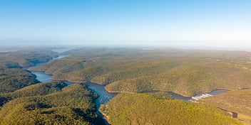
The NSW Government’s Reconnecting River Country Program aims to achieve a balance of economic, social, cultural and environmental outcomes across the southern NSW Riverina region, both now and in future.
Launched in 2021 and led by extensive on-ground consultation with landholders and communities, the program focuses on creating pathways for the successful relaxation of constraints to deliver water for the environment, where and when it is needed.
Acting CEO of Water Infrastructure NSW Ingrid Emery said removing or relaxing flow constraints along the Murray and Murrumbidgee rivers will enable the government to apply environmental water more efficiently and effectively.
“The Reconnecting River Country Program is one of NSW’s major commitments under the Sustainable Diversion Limit Adjustment Mechanism (SDLAM). It aims to remove physical, policy and operational barriers to getting water for the environment through to our floodplains and wetlands,” she said.
“This means that we will be able to utilise the environmental water that we already recovered from those communities in the best possible way.
“It’s not about saving more water or getting more water back off water users, it’s about using the water the environmental water holders already have most effectively and efficiently, an endeavour which so far has been impeded because of those barriers.”
The Murray-Darling Basin Authority estimated the program is likely to prevent approximately 60GL of water buybacks, enabling strong environmental outcomes without negative economic consequences for communities.
“The SDLAM program is contributing to the environmental water recovery targets by reducing the need for the Commonwealth Government to purchase additional water for the environment,” Emery said.
“Under the Reconnecting River Country Program, we expect that we will be able to deliver the equivalent of environmental outcomes of saving 60GL of water. It means we don’t have to buy back that water from water users.”
Supporting Riverina communities
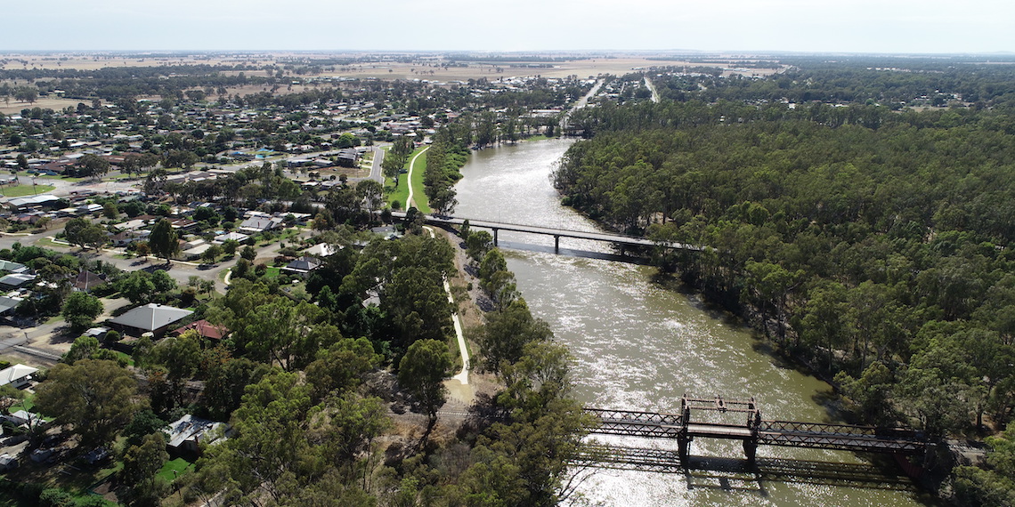
With the program extending across dozens of rural communities along the Murray and Murrumbidgee Rivers, Emery said the scope of benefits set to be delivered under the program will also help bolster local amenity and regional economies.
“The program not only contributes to the SDLAM offset, reducing the need for further water recovery, it will also involve extensive investments in local bridges, roads and other infrastructure, which provides a boost to those communities,” she said.
“It also helps reduce inundation impacts from natural river flows. Improving the infrastructure means that these communities will be less likely to have negative impacts during natural events, like the flooding events we’ve got right now.”
Emery said the program’s proposed flows will also benefit First Nations communities by improving the connection between healthy Country and healthy culture and community.
“Water is critical to Aboriginal people, and by restoring the health and connectivity of those floodplains and wetlands we are returning cultural values to Aboriginal people,” she said.
Another key benefit is supporting the recreational fishing industry, Emery said, with healthy and connected rivers bolstering biodiversity, habitat and species populations.
“By better connecting the water to the floodplains and wetlands, we are going to be able to restore the vegetation communities, and help increase the abundance and breeding habitat of native fish and fauna,” Emery said.
“Improving wetland and floodplain connectivity supports healthy and productive waters, it creates better fish passage and breeding, better habitats for waterbirds and other wildlife.
“These are really critical, long-term benefits for the environment that will lead to benefits for the community, as well. By ensuring the river systems stay healthy, it creates more amenity and community engagement.
“People will be more likely to come to these river communities for holidays and recreation if the waterways are thriving.”
Mapping flow allocations
The program is facilitated online via a recently launched virtual hub, enabling virtual consultation with landholders, as well as a recently released inundation tool, providing access to the program’s modeled inundation extents in an interactive map.
“We have been progressively releasing inundation maps for various stretches of the Murray and Murrumbidgee rivers since about July. We have done some really extensive hydrological modelling, and the tool is the outcome of that work,” Emery said.
“The online maps allow people to see where the inundation areas will be at different flow rates. It also has some imagery from the 2021 high-flow events, so we can compare future proposed flows to the 2021 event.”
Emery said that although the 2021 high-flow events have now been exceeded by the recent 2022 high-flow events, the maps still show that the proposed flows under the program are nowhere near as high as the 2021 event.
“The current water levels being experienced across the Riverina are well above the flows being considered for the program,” she said.
“There are a lot of stakeholders concerned that the water levels under the program will be that high. But that is absolutely not the case, which is why the inundation mapping tool is so useful because it helps us engage in those conversations.”
The tool is set to bolster further engagement with landholders, Emery said.
“You can look at the river stretches on a macro scale, but you can also zoom in to look at much smaller stretches of the river system,” she said.
“The mapping tool also helps people see what our flow regimes look like in practice.
“We’ll be taking the inundation mapping tool to landholders to verify that our modeling is what they experience in practice, and also to discuss and engage with them about preferred flow regimes.”